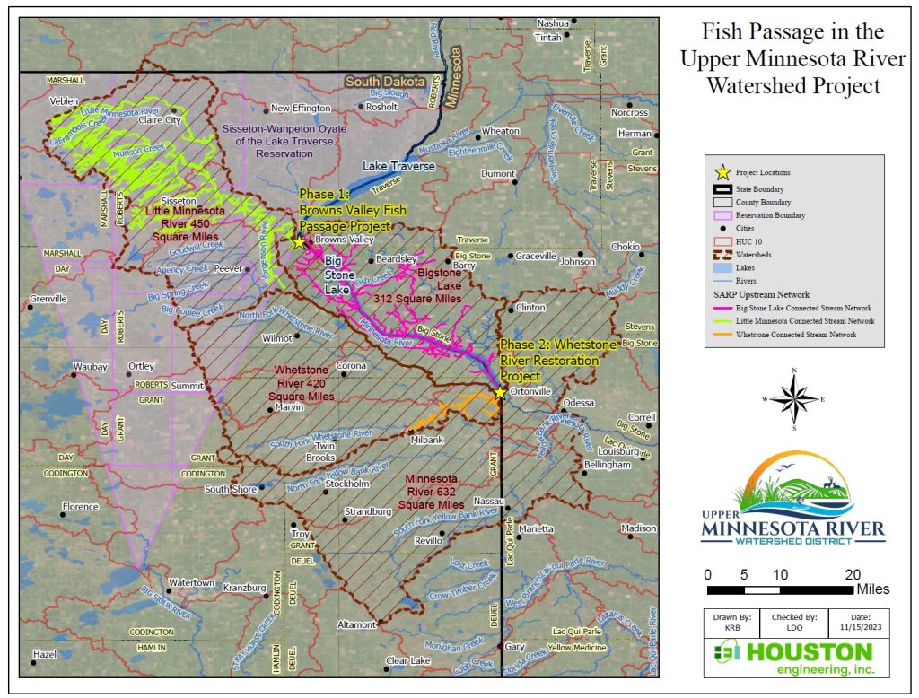
Fish Passage in the Upper Minnesota River Watershed
This two-phased watershed approach to flood control and habitat restoration combines the need for fish passage into the Little MN River via the Browns Valley Flood Diversion and the longstanding efforts to restore a portion of flows into the previously diverted Whetstone River.
Cumulatively, the multiple phases of the Project will reconnect 543 miles of the Little Minnesota River stream network, 199 miles of Big Stone Lake stream network, and 38 of the Whetstone River stream network (780 miles of upstream network total) with 9 miles of downstream network through the Big Stone National Wildlife Refuge.
Click Here for more project information.
Big Stone Lake
and Whetstone River Dam Operations
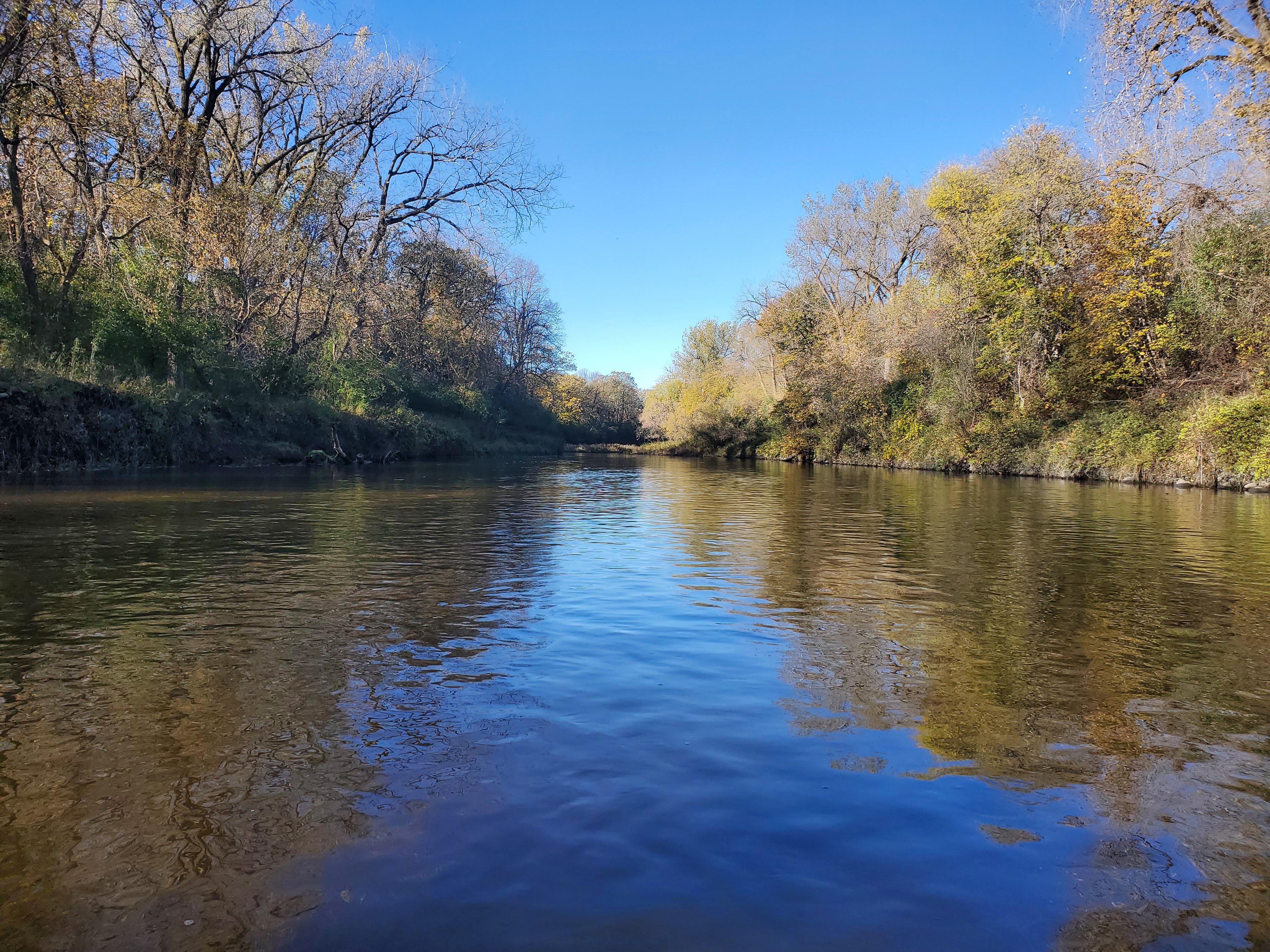
Big Stone Lake was formed at the end of the last ice age when glacial Lake Agassiz drained through the gap into Glacial River Warren. The valley of that river now holds Big Stone Lake.
The Lake covers 12,610 acres of surface area, is 26 miles long and averages about 1 mile wide. Big Stone Lake is a border water, separating Minnesota and South Dakota
READ MORE
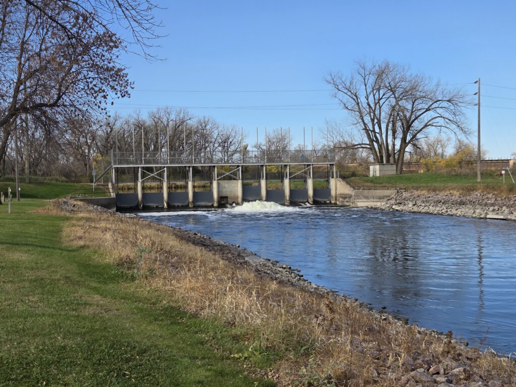
Whetstone River Restoration Project
The Whetstone River Restoration will hydrologically and ecologically reconnect a portion of the Whetstone River to the Minnesota River. By default, this will improve conditions within
Big Stone Lake reducing nutrient loads, improving water quality and reducing flooding…. READ MORE
Browns Valley Flood Hazard Mitigation Efforts
The March 2007 flood caused substantial damages to the City of Browns Valley, Minnesota (the “City”) placing severe social and economic hardship on the residents and the community. Unfortunately, the spring 2007 flood is one of several documented floods dating back to the early 1940’s that have affected Browns Valley….. READ MORE
WRAPS
The State of Minnesota uses a “Watershed Approach” to assess and address the water quality of each of the state’s 80 major watersheds on a 10-year cycle. The WRAPS report summarizes the Minnesota Pollution Control Agency’s (MPCA) Watershed Approach findings, addressing the fishable, swimmable status of surface waters in the Minnesota River Headwaters Watershed.
Click HERE to download the DRAFT Report
One Watershed, One Plan
The Upper Minnesota River Watershed Partners have locally adopted a Comprehensive Watershed Management Plan
The planning area for the Upper Minnesota River One Watershed, One Plan includes portions of Traverse, Big Stone, Swift, Stevens and Lac qui Parle Counties.
The Plan can be downloaded here.
For more information, or to provide comments on the plan, please contact the Partnership’s Grant Administrator, Amber Doschadis at 320-839-3411 or [email protected]
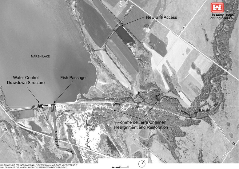
Marsh Lake Ecosystem Restoration
The Marsh Lake Project Area is located on the Minnesota River between Swift and Lac qui Parle counties near Appleton, Minnesota. As shown in the map below, the project site lies within the Lac qui Parle Wildlife Management Area. It is also downstream from the U.S. Fish and Wildlife Service’s Big Stone National Wildlife Refuge. The U.S. Army Corps of Engineers (USACE) owns and maintains Marsh Lake Dam as part of the Lac qui Parle Flood Risk Management project. The dam holds a conservation pool in the upper portion of the Lac qui Parle Reservoir.
Click HERE to be directed to the USACE Project’s Page